Empower Success with Geospatial AI-Driven Solutions
Discover how my AI-driven solutions and expertise in geospatial data and public health can help you overcome challenges and set new standards for success in your endeavors.
TECH FOR PUBLIC HEALTH
Unveiling the Power of GeoAI in Revolutionizing Public Health
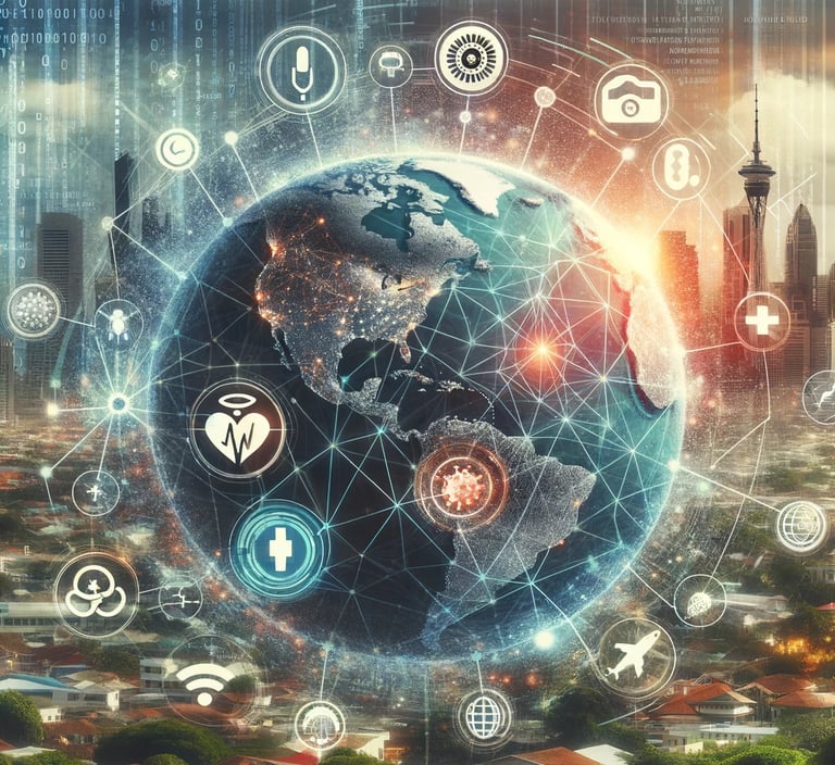
In the face of the unprecedented global challenge posed by the COVID-19 pandemic, digital transformation and public health fields have converged like never before. This era illuminated the remarkable capabilities of geospatial technologies and artificial intelligence (AI) in navigating the complexities of pandemic management and public health. Integrating map dashboards, AI-driven hotspot detection, and strategic vaccination rollouts underscored a new frontier in health technology—GeoAI. This blog post delves into the intricacies of GeoAI, exploring its foundation, applications, and transformative potential in public health.
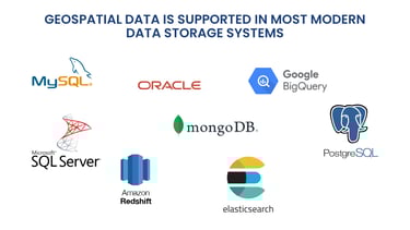
This ubiquity is supported by major data storage systems, including relational database management systems like PostgreSQL (with its spatial extension PostGIS), Oracle Spatial, and cloud storage solutions from Amazon and Google, all of which facilitate spatial data storage and analysis.

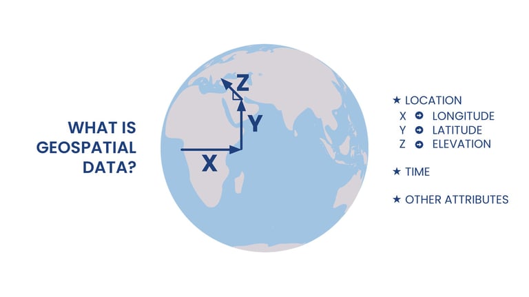

Geospatial data—coordinates that pinpoint locations on the Earth's surface—is more prevalent than ever, thanks to advancements like GPS and platforms such as Google Maps.
The Synergy of Geospatial Data and Artificial Intelligence
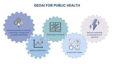
GeoAI represents the fusion of geospatial analysis with artificial intelligence. It's not merely adding a geographical component to AI but a sophisticated blend that enhances our ability to interpret and act upon the vast datasets of our world. This integration is pivotal in public health, where understanding the interplay between environmental factors and human behavior is crucial for disease prevention and control.
This approach was exemplified in a project with the World Health Organization (WHO), where exploratory analysis of disease case counts across Africa integrated environmental and demographic data. Spatial autocorrelation techniques revealed how disease prevalence in neighboring districts could predict local outbreaks, illustrating the critical role of geospatial analysis in disease prediction and prevention.

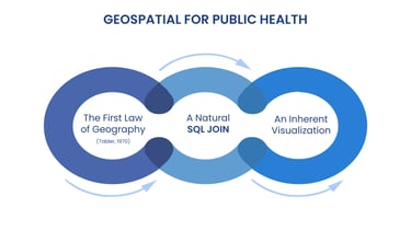
The essence of geospatial relevance in public health can be traced back to Dr. Walter Tobler's first law of geography: everything is related, but proximity increases relevance. This principle is particularly resonant in public health, where geographical proximity often influences disease spread. GeoAI takes this concept further by enabling data fusion through spatial joins—linking datasets based on location to unveil patterns, trends, and anomalies.
Leveraging Geography for Health: The First Law and Beyond

Projects like Meta's high-resolution population density estimates and WorldPop's detailed demographic datasets exemplify how GeoAI can create valuable public health planning and intervention resources. These initiatives demonstrate the potential of GeoAI to synthesize complex data into actionable insights, a capability that's increasingly crucial in a world where traditional data collection and analysis methods fall short.
Today, GeoAI facilitates a broad spectrum of public health initiatives, from HealthMap's global health situation dashboard to WHO's Epidemic Intelligence from Open Sources (EIOS), which uses AI to monitor news for outbreak detection.
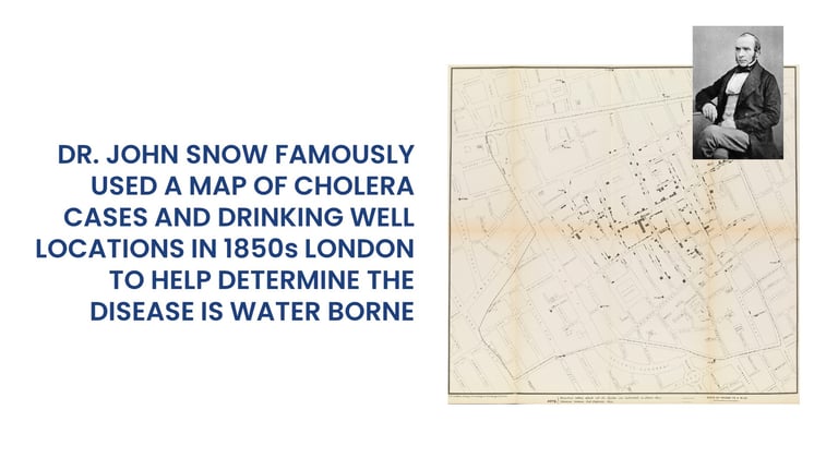

The application of geospatial analysis in public health has been introduced previously. The pioneering work of Dr. John Snow in the 1850s, mapping cholera cases in London to identify a contaminated water source, is an early example of leveraging location data for health insights.
GeoAI in Action: From Historical Precedents to Modern Innovations
As we look to the future, integrating GeoAI into public health strategy offers vast opportunities for enhancing disease surveillance, response, and prevention. GeoAI's ability to rapidly process and analyze large datasets allows for real-time insights, enabling quicker and more effective public health responses. However, this potential comes with challenges, including data privacy concerns, the need for interdisciplinary collaboration, and the ongoing development of robust, accurate AI models.
The journey of GeoAI in public health is an evolving narrative of technological innovation with the power to transform our approach to health crises and routine care. We can unlock new possibilities for understanding and improving public health outcomes by fostering collaboration across geography, AI, and health science.
In conclusion, the convergence of geospatial technologies and artificial intelligence heralds a new era in public health. GeoAI not only empowers us to tackle the immediate challenges of pandemic response but also lays the groundwork for a future where health interventions are more nuanced, targeted, and effective. As we continue to explore and expand the boundaries of GeoAI, the promise of better health outcomes for all remains a compelling call to action.
The Future of GeoAI in Public Health: Opportunities and Challenges
Intro to GeoAI in Public Health | For Improved Outcomes

Let's shape the future of public health together with AI-powered geospatial insights
Contacts
scottpez@brightworldlabs.com