About Me — Applied Research in AI and Geospatial
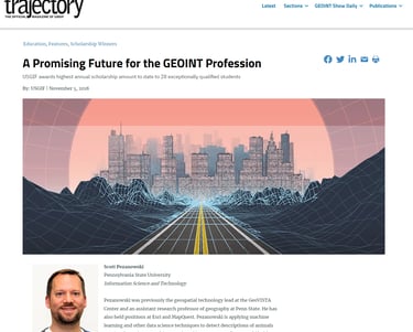
Dr. Scott Pezanowski
I solve your complex problems using AI-driven geospatial insights. My service suite extends beyond project execution to encompass expert consulting and tailor-made training designed to empower your team with the knowledge and tools for continued success.
I bring over 25 years of experience in applied research with AI, geospatial, and public health to tackle your most complex challenges. My experience spans collaborations with prestigious entities such as the World Health Organization (WHO), national agencies like the Department of Homeland Security, elite private corporations, and top-tier research universities.
I leverage AI to decipher intricate patterns and forecast disease spread for organizations like WHO. I deliver solutions and transformative outcomes that drive your organization forward, lead public health advancements, and set new benchmarks in innovation and impact.


Projects
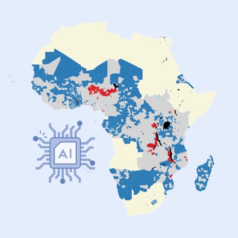
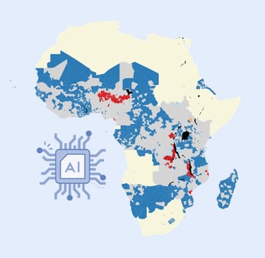
Predictors of Disease Outbreaks at Continental-Scale in the African Region: Insights and Predictions with Geospatial AI Using Earth Observations and Routine Disease Surveillance Data
Methods: Machine Learning, Text Analytics, Visualization, Public Health
Derive insights into disease epidemic data in Africa.
Apply expert data science techniques to uncover patterns of disease-contributing factors and make future predictions.
Implement ML text classification for disease news article detection and monitoring.
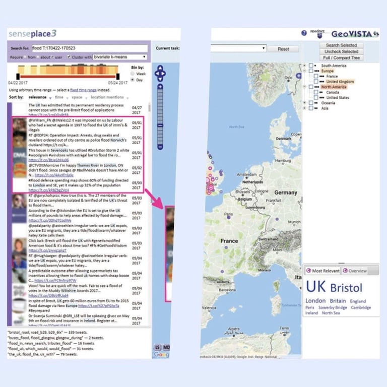
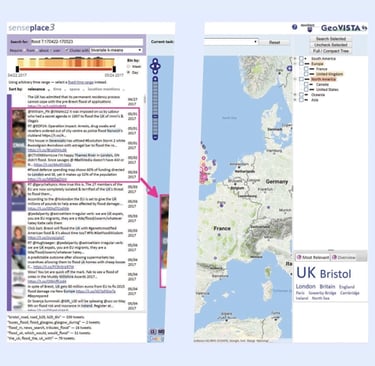
Methods: Visual Analytics, Natural Language Processing, Social Media Analytics, Public Health, Disaster Management
Harvesting, processing, storing, searching, and retrieving massive amounts of social media data to monitor crisis events.
Natural language processing to extract place, people, and organizations text and geocode places.
Information retrieval and search engine technology return the most relevant tweets.
Full stack geovisual web application development involving Postgresql/PostGIS, Java web services, JavaScript mapping, visualization, and APIs for human-in-the-loop analysis.
Devised many strategies to handle, process, search, and display nearly 30 million monthly tweets in near real-time.


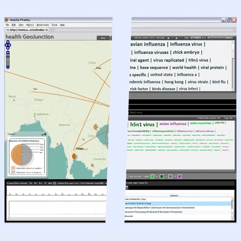
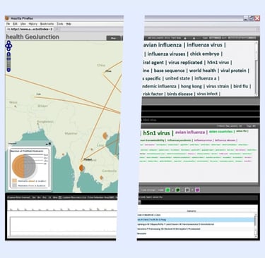
Methods: Visual Analytics, Text Analytics, Sense-Making, Health
Extracting and visualization of knowledge from vast amounts of news articles for disease spread monitoring.
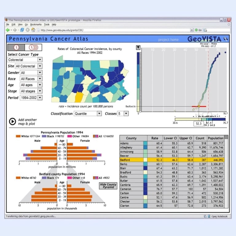
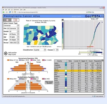
Methods: Visual Analytics, Public Health, Chronic Disease Management
Data fusion and visual analytics of cancer data with ingenious and intuitive filtering to identify critical factors affecting the disease.
Methods: Visual Analytics, Text Analytics, Sense-Making, Health
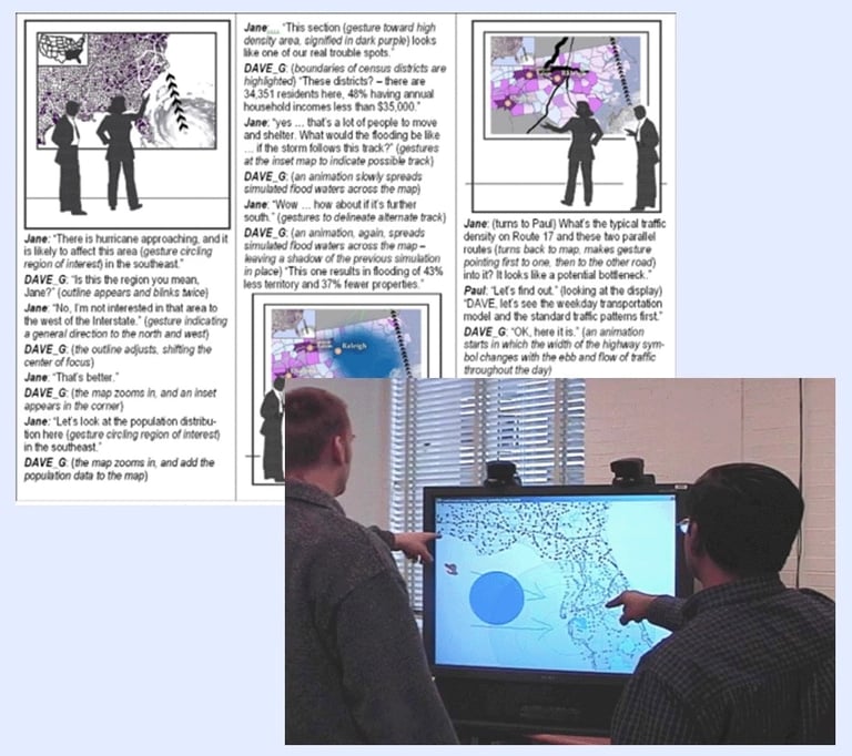
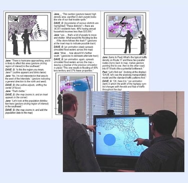
Let groups utilize geospatial technologies in crises with large-screen speech and gesture-based collaborative interfaces.
Publications
Applied research using AI and geospatial
Minimize risk and maximize impact through AI-driven public health strategies with me as your trusted partner. Read more about my interdisciplinary approach in my research articles.
Awards
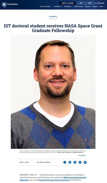
Based on my academic, research, and outreach activities, I was chosen by the Pennsylvania Space Grant Consortium to receive a NASA Space Grant Graduate Fellowship.
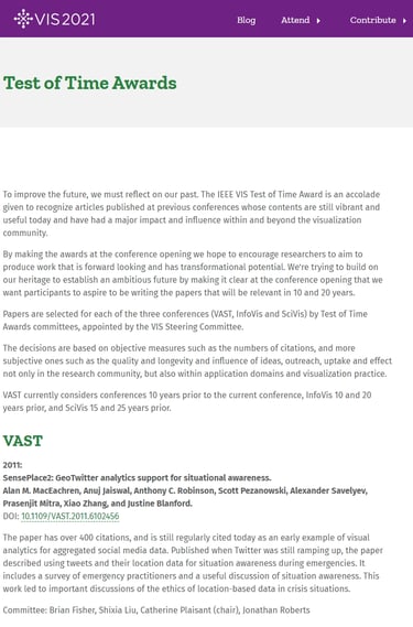
My colleagues at The Pennsylvania State University and I received this award from IEEE at the Vis 2021 conference for our 2011 paper, "SensePlace2: GeoTwitter analytics support for situational awareness."
It honors research that made a substantial impact and is still relevant after 10 years.

After a highly competitive and multi-tiered review by a distinguished independent panel, I was chosen by the United States Geospatial Intelligence Foundation (USGIF) to receive a Doctoral Scholarship.
Inquire about partnering
By partnering with me, you gain access to unique, state-of-the-art solutions that reveal crucial health patterns and optimize the prediction and management of health trends.