Rethinking Healthcare Site Selection for the Future with AI
Imagine a world where AI-driven insights help us strategically locate healthcare facilities, bringing essential services to underserved areas and reshaping how we address healthcare access gaps. In this blog, we’ll explore how multimodal AI and advanced geospatial analysis revolutionize healthcare site selection, taking a groundbreaking approach that can adapt to diverse and challenging environments.
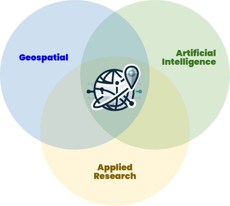
SCIENTIFIC INSIGHTS INTO AI AND GEOSPATIAL TECHNOLOGIESTECH FOR PUBLIC HEALTH
Scott Pezanowski
11/24/20247 min read


Traditional Geographic Information System (GIS) methods have been invaluable when deciding where to place new healthcare facilities, especially in identifying healthcare deserts – regions severely lacking medical resources. However, the latest advancements in AI are pushing the boundaries of what’s possible. Multimodal AI, which combines various data forms like population density, road networks, and land cover, offers unprecedented accuracy in predicting suitable healthcare sites.
In a recent study, researchers successfully applied multimodal AI to healthcare site selection in Ghana, achieving remarkable precision. This model stands out not only because it combines spatial data with machine learning but also due to its high scalability, allowing for quick adaptability across countries and regions. The results offer a promising glimpse into the future of healthcare planning, especially in developing nations.
Douard, N., LaRovere, J., Harris, M. D., McCann, C., Nasseri, A., Parmar, V., Straulino, D., Hanson, C., Bataglia, M., Afshin, E. E., Filiaci, M., Azzarelli, K., Giakos, G., & Elahi, E. (2023). Spatial Suitability Analysis for Site Selection of Healthcare Facilities Using a Multimodal Machine Learning Approach. 2023 IEEE International Conference on Imaging Systems and Techniques (IST), 1–6. https://doi.org/10.1109/IST59124.2023.10355652
The Power of Multimodal AI in Public Health
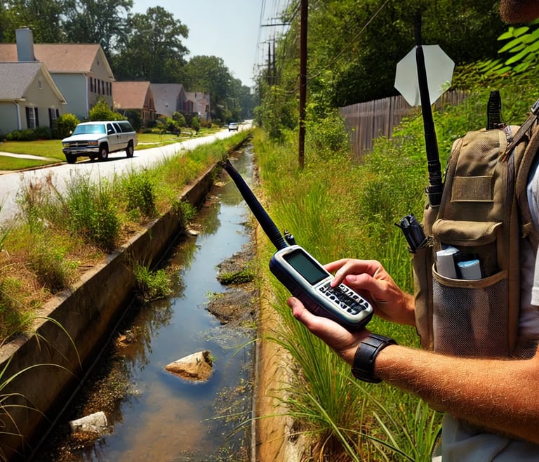
One of the key takeaways from this model is its versatility in analyzing geospatial data, a technique that has significantly enhanced healthcare planning across regions with diverse needs. I've used similar AI and geospatial data integration approaches, such as mapping mosquito breeding sites to predict disease outbreaks in specific urban areas. This project demonstrated how AI-driven analysis could reveal patterns otherwise hidden, underscoring the power of multimodal approaches in making accurate predictions with real-world impact.
Why Multimodal AI?
The multimodal approach isn’t just a new tool but a significant leap forward in healthcare planning. Traditional methods rely on data such as land cover and population density but often require country-specific adjustments that can be time-consuming and expensive. On the other hand, Multimodal AI processes various layers of geographic and demographic information into visual data, making it ideal for machine learning applications.
The authors developed an attractive geospatial machine-learning pipeline for their methods. This pipeline combines multiple feature layers, such as population density, road networks, and elevation, as stacked rasters to classify areas for healthcare suitability. They converted the vector layers to rasters. Stacking raster layers is important because it effectively combines spatial features into a robust predictive model.
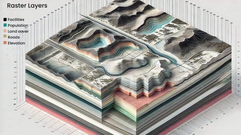

In the Earth observation field, this concept of stacking raster layers for machine learning training data is known as a deep cube, or sometimes I hear data cube. So, you have multiple data layers stacked along a z-axis to go with your spatial x and y-axis. One of these layers is the phenomenon you are trying to predict, like the location of healthcare facilities. This methodology is gaining popularity in geospatial AI because the model can learn some spatial relationships in variables and relationships between variables in space, and machine learning works well with images or raster data.
The study uses LightGBM with Early Stopping as the classifier. Early stopping means the model stops training once it fails to improve or learn, preventing overfitting. Overfitting means the model will only work on the training data rather than generalize to larger datasets.
Data-Driven Insights: Understanding the Needs of the Population
One of the cornerstones of effective site selection is understanding population distribution and needs. In this case, population density data from sources like WorldPop was vital. This approach resonates with my work in forecasting disease outbreaks, where I analyzed environmental and demographic data to predict disease spread. The value here is clear: integrating comprehensive datasets gives us a holistic picture of public health needs, which can inform decisions about healthcare site placement and resource allocation.
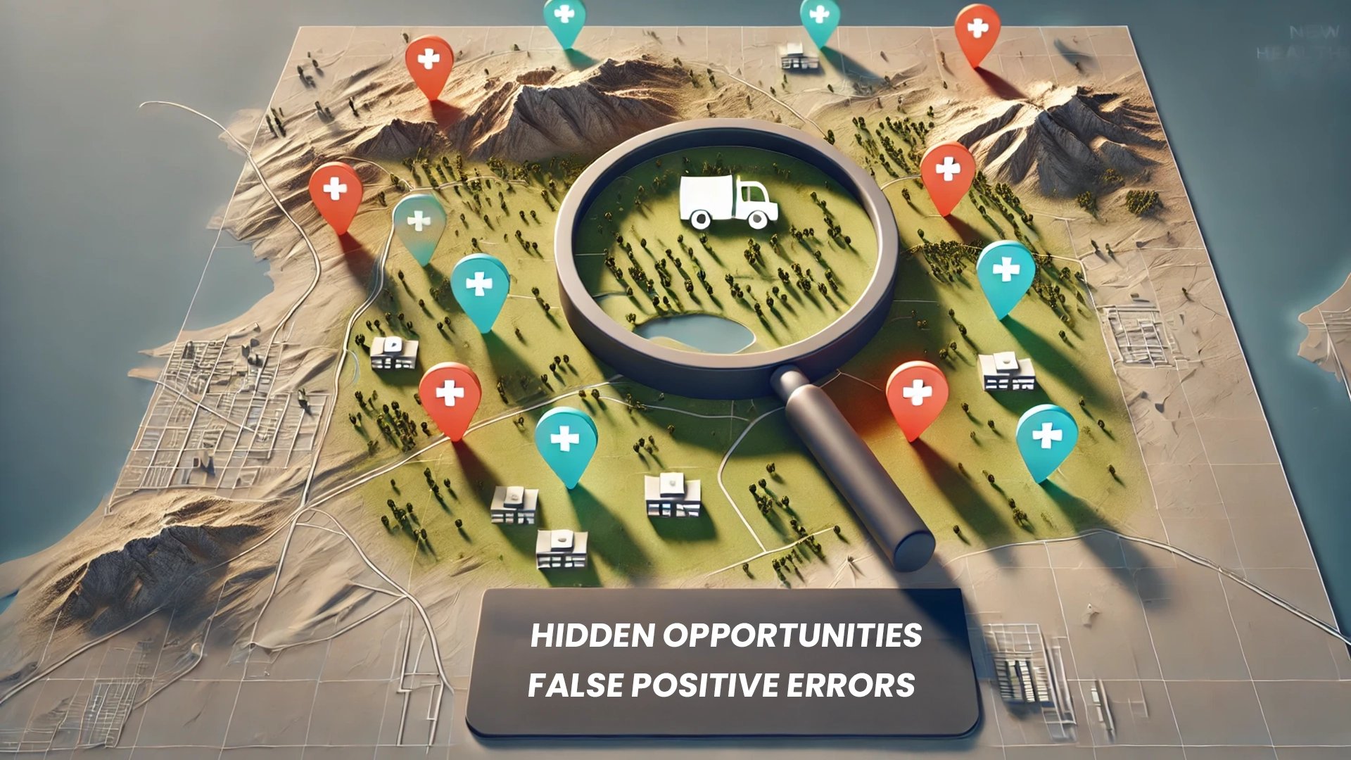
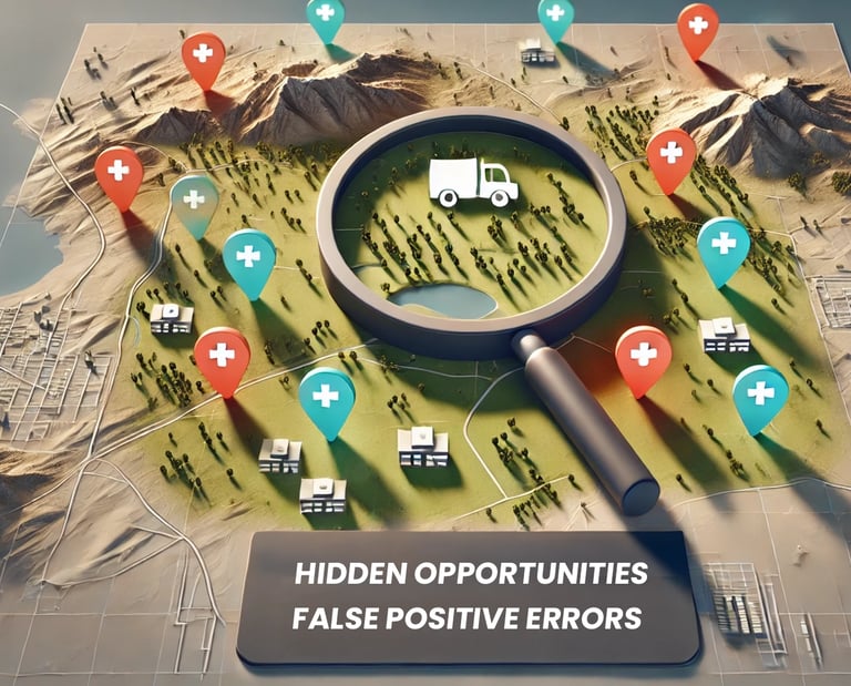
The model’s use of false positives in site prediction – identifying locations where the model suggests a healthcare facility should exist but currently does not – is a clever innovation. These false positives become potential candidates for new facilities, turning model errors into actionable insights. Using AI in this way allows us to rethink limitations and turn them into opportunities for practical decision-making.
The Impact of Geospatial Analysis in Healthcare Planning
This study highlights the incredible potential of geospatial analysis combined with AI to identify healthcare deserts. This mission aligns closely with my projects to improve public health through space-based observation. For example, my research on predicting disease outbreaks at the African district level leverages Earth observation data to help identify areas most at risk. As with healthcare site selection, geospatial analysis enables us to address underserved populations more effectively and provide decision-makers with clear, data-backed insights.
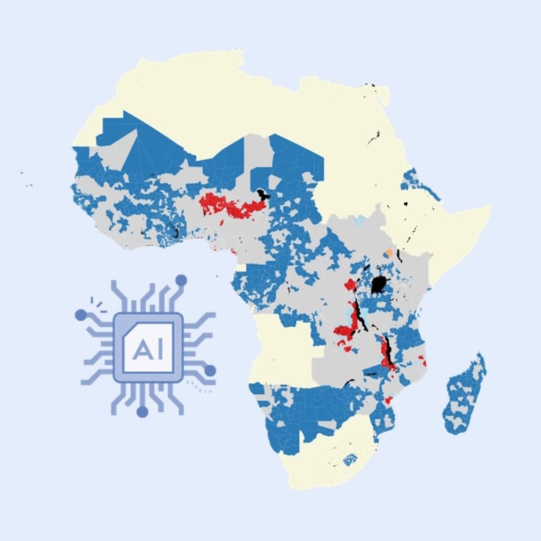
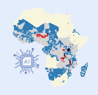
Pezanowski, S., Koua, E. L., Okeibunor, J. C., & Gueye, A. S. (2024). Predictors of disease outbreaks at continental-scale in the African region: Insights and predictions with geospatial artificial intelligence using earth observations and routine disease surveillance data. DIGITAL HEALTH, 10, 1–15. https://doi.org/10.1177/20552076241278939
Elevating Healthcare Access in Developing Regions
This AI-powered site selection model is not only accurate but adaptable. Its success in Ghana demonstrates the potential to expand healthcare access in regions where it’s needed most, particularly in low and middle-income countries. A scalable model such as this can be a game-changer for global health organizations, government bodies, and NGOs that need efficient and data-driven solutions to optimize healthcare access across various geographic and socio-economic landscapes.
How I am Contributing to Global Health Solutions
I aim to harness the power of AI and geospatial analysis to bridge the gaps in healthcare access, particularly in underserved areas. My collaborations with organizations such as the World Health Organization have already demonstrated the value of combining environmental and health data to predict disease outbreaks, guiding healthcare resource allocation where needed most. My projects prove how AI-driven insights can benefit public health infrastructure globally.
Scaling Multimodal AI Across Industries
While this model’s primary application is in healthcare site selection, its approach has broad implications for other sectors. Industries such as retail, banking, and education can also leverage multimodal AI to make informed decisions about location planning. Imagine a model that considers customer demographics, competitor locations, and transportation accessibility to predict ideal spots for new retail locations – a powerful tool for companies seeking to optimize operational efficiency and maximize return on investment. So, let's imagine a scenario where a restaurant chain, coffee shop chain, bank, or a company that owns real estate uses data on their existing assets and finds optimal locations throughout the entire country or beyond that can produce a successful new store or branch.


A Closer Look at Model Refinements and Future Potential
Even with its impressive accuracy, there are always opportunities to refine and expand on this AI model. For instance, adding travel time data could make site selection even more precise, accounting for ease of access in remote or rural areas. Additional layers, like high-resolution demographic data, could further tailor recommendations to meet the specific healthcare needs of various population groups. These improvements would enhance the model’s value, making it more applicable across different regions and use cases.
From a technical perspective, incorporating cost analysis would add another layer of practicality, ensuring that recommended sites align with budget constraints. This cost analysis would particularly benefit organizations working in resource-limited settings where construction costs may be a limiting factor.


Bridging the Gap: How AI is Shaping the Future of Healthcare Access
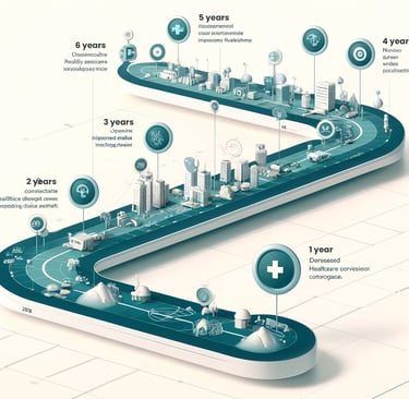
This model exemplifies the groundbreaking potential of AI and geospatial analysis to drive equity in healthcare access. As we look toward the future, it’s clear that such innovations have the power to reshape healthcare planning on a global scale. By offering data-driven insights that account for complex spatial patterns, AI can help decision-makers optimize resource allocation, reduce operational costs, and improve the quality of life for underserved populations.
My work continues to push the possibilities with geospatial AI, from predictive modeling in public health to comprehensive biodiversity mapping efforts. I dedicate myself to building tools and solutions that provide actionable insights for immediate applications and long-term planning.
Partnering for a Healthier Future
If you are a healthcare decision-maker, government official, or global health organization, these AI-driven tools can support your mission to improve healthcare access. I offer consulting services to help organizations develop data-driven models tailored to your needs. My expertise in geospatial analysis, machine learning, and public health provides a strong foundation for collaborative partnerships that drive impactful change.
I am excited to contribute to a future where healthcare access is optimized and data-driven insights empower effective decision-making. Let’s work together to bring essential services to the communities that need them most and build a world where healthcare access is no longer a privilege but a right.
Check out the full video to learn how multimodal AI and geospatial intelligence can scale healthcare site selection reducing costs and alleviating healthcare deserts.

"[Scott] is extremely patient, hardworking and possess the necessary skills to develop viable solutions using the latest technologies and methods available. He is able to assess end-user needs, translating them using the latest cutting-edge AI and Machine Learning methods and geospatial technologies. His technical skills are top."
- Professor Dr. Justine Blanford | Geo-Information Science and Earth Observation, University of Twente